
Historic maps, aerials, images
East Bay shorelines, watercourses, and landscapes are always changing. These historic maps and images aim at giving some insight into the rapid and profound changes since European settlement.
This page is a work in progress. Some images have not yet been copied from our old web site, as we decide which to use. Some of these are parts of larger documents, missing proper sources and credits. Apologies — many were copied on paper for personal use, years ago before widespread Internet use and proper credit is needed.
Many historic maps and images are easily found online. For starters, check the online collections of UC Berkeley libraries and local historical societies.
Click on the thumbnail to see a larger , complete image.

US Coast Survey 1853 map of Cerrito Creek winding through marsh north of Albany Hill, and Pt. Isabel, a low hill joined to mainland by marsh.

1856 US Coast Survey map shows willow groves at Strawberry Creek’s mouth. Schoolhouse, Codornices, and Marin creeks peter out east of a marsh where a tidal slough carried their waters north-northwest to the Bay, behind the hill and bluff at Fleming Point

In 1869 the state began selling the Bay’s shallow shorelines for fill or other uses. Not all were sold, and the state retained important rights. This 1878 map shows parcels and development at that time.

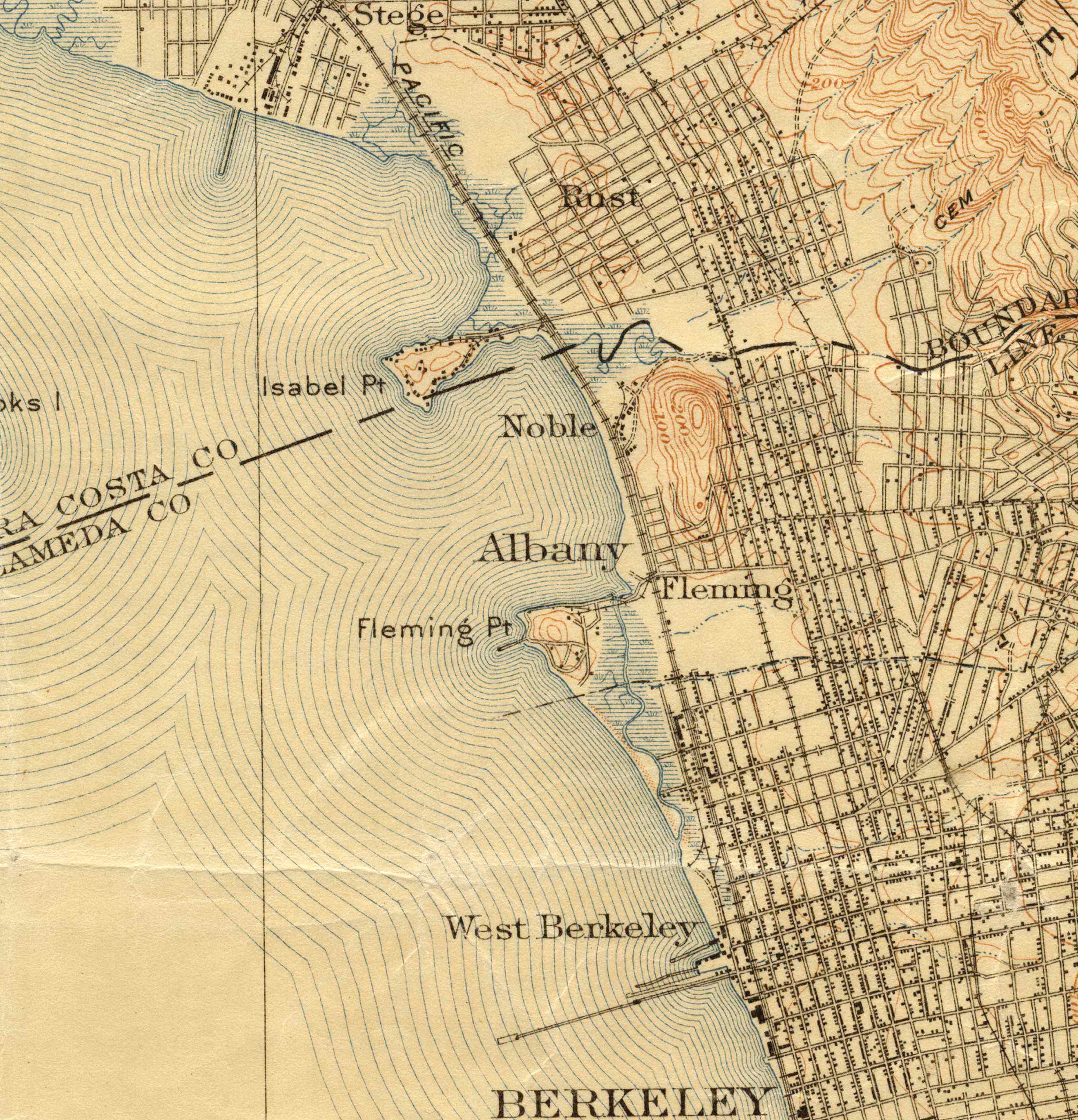
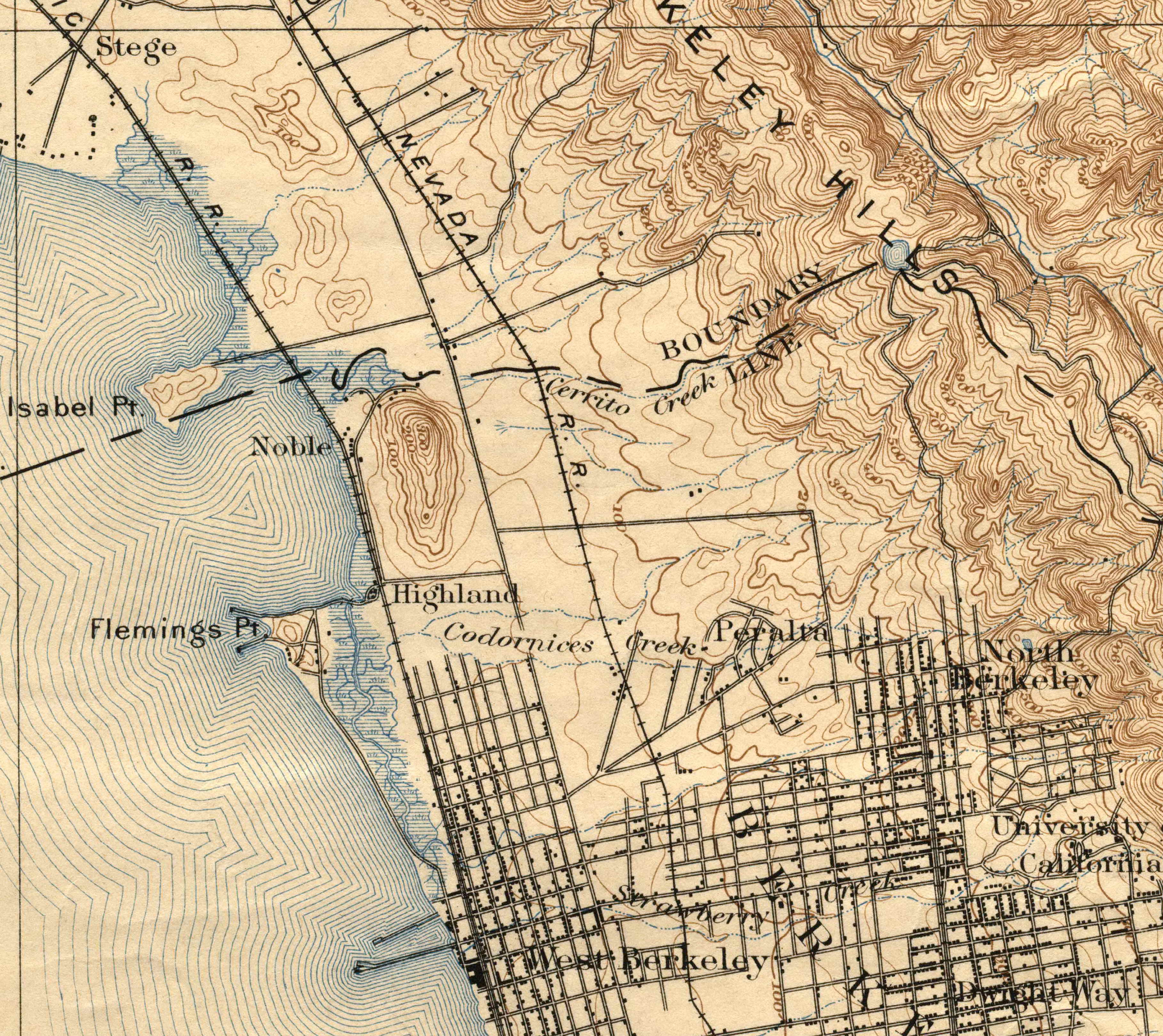
The 1895 USGS map shows railroads, including the inland California & Nevada right of way that became the Santa Fe and later BART. Before the San Francisco earthquake, Berkeley barely reached Codornices Creek. Farther north, development was mostly agriculture and dynamite.

Booming after SF’s Great Earthquake, by 1915 Albany was a city, Rust was a nucleus of El Cerrito, and development had reached today’s Kensington. Dynamite and polluting manufacturing had shifted north. Shoreline fill, though, had barely begun,
. Built on fill, this first version of today's freeway had cut off a long, shallow finger of Bay. The Depression-era Works Progress Administration built pipes to allow circulation, creating today's Aquatic Park. An early version of Berkeley's Yacht Harbor used part of the long ferry pier; servce had failed years before. Golden Gate Fields racetrack, recently built, had also failed as horses sank in the marshy fill. The military would sieze and transform it and the marshy land behind.")
In 1942, as WW II broke out, the shoreline was changing. A new Bay Bridge was getting traffic on a new I-50 (now 880). Built on fill, this first version of today’s freeway had cut off a long, shallow finger of Bay. The Depression-era Works Progress Administration built pipes to allow circulation, creating today’s Aquatic Park. An early version of Berkeley’s Yacht Harbor used part of the long ferry pier; servce had failed years before. Golden Gate Fields racetrack, recently built, had also failed as horses sank in the marshy fill. The military would sieze and transform it and the marshy land behind.